Tuesday, June 9, 2015
Mt Mansfield Summit
MT MANSFIELD SUMMIT ( 4,293')- National Trails Day Hike,
Saturday June 6, 2015.
8:30 am 12:45 pm Overcast and eventual clearing.
Underhill State Park, Sunset Ridge Trail to Long Trail to the Chin. Descent down Long Trail to Laura Cowles trail and back to Underhill State Park.
Sunday, April 26, 2015
Mobb's Hill
Mobb's Farm -46 degrees with sun and clouds and slight breeze. Jericho, Vermont
9-10:15 am. A short planned weekend hike to new area I recently discovered.I climbed up through boulder strewn ridge on unmarked trail from Fitzsimmons Road. There was some mud and a few spring freshets and vernal pools on the many unmarked trails that intertwine and go off in all directions. I looked at a map early on and head downhill towards the east with no problems. A wide cart track winds its way through a 50's car graveyard with several rusted hulks including a mercury with huge chrome front end and several oil pails litter the ground shot through with bullet holes.
I observed a red squirrel, hairy woodpecker knocking into a tree and a grey squirrel as well as other common birds. Atop the hill and looking west are views towards the lake seen through the trees. I follow the arrow markings in red down a gulch and past a group of hemlocks clinging to the edge of the ridge with obstructed views looking west. After a brief descent I come out of the woods onto the capped town landfill covered in brown grasses and soggy from the thaw and spring rains. I walked along the perimeter bordered by stunted pine shrubs and paper birch.
I noticed an adjacent farm meadow and decided to climb up the property. I followed a stone wall to the top where several brush piles have been carefully erected for a future controlled burn. The open space allowed for a fantastic view of the distant pine and leafless tree covered hills. A grey and green tapestry that would make for a fine translation into paints and colored pencil. A great spot to return with my art supplies. I scribbled into my green pocket notebook and sat for a moment to enjoy the sun on my face.
There is a trail on the other side of the stone wall and I was able to follow the trail back to the parking lot. I passed a family with two kids and their two dogs who were exploring the car graveyard before I reached the road.
Thursday, May 22, 2014
"He dared to lead where others dared to follow."
5/14/14 Wed 1-4pm. Mashamoquet State Park, Pomfret, CT
5 mile hike with mix of sun and clouds and chilly start.
Me and my Father started up the blue trail above the parking lot and visitor center and climbed a steep rise. Three large military cargo planes flew maneuvers overhead and veered off as if taxiing to a runway.
There are a large network of stone pasture walls. I spotted a lady slipper along the trail. We hiked up several rocky mounts before coming to the Indian Chair in which we sat in to take in the sights and take advantage of the photo op.
I am currently reading "War On The Run" by John F. Ross the story of Robert Rogers and the conquest of America's first frontier. In it he describes Israel Putnam a farmer in Pomfret, CT who would become a hero of the Revolutionary War. In the spring of 1743, when Putnam was 25, him and his neighbors tracked a she-wolf that had devastated farms for years in Northwestern Connecticut and even killed 70 of his sheep and goats in one night at his farm. Put and his neighbors tracked her paw prints through the snow to a narrow cave. Eventually they killed it and dragged it out of the cave by its ears. A placard marks the spot.
We hiked to table top rock to Wolf's Den Drive and then continued on the blue trail. At this point the landscape changed to a more rolling bottom land hike past pastures and farmland. I noticed hoof prints from horse tracks along the trail. We came down to Mashamoquet Brook and some ruins of dam works along the yellow trail. The blue trail continued down to the entrance to the park with just a short walk to the lot. The 5 mile loop ended up being more of a hike then we bargained for but the history of the place was worth it.
5 mile hike with mix of sun and clouds and chilly start.
Me and my Father started up the blue trail above the parking lot and visitor center and climbed a steep rise. Three large military cargo planes flew maneuvers overhead and veered off as if taxiing to a runway.
There are a large network of stone pasture walls. I spotted a lady slipper along the trail. We hiked up several rocky mounts before coming to the Indian Chair in which we sat in to take in the sights and take advantage of the photo op.
We climbed a steep hill and arrived at the legendary Wolf's Den cave. I am currently reading "War On The Run" by John F. Ross the story of Robert Rogers and the conquest of America's first frontier. In it he describes Israel Putnam a farmer in Pomfret, CT who would become a hero of the Revolutionary War. In the spring of 1743, when Putnam was 25, him and his neighbors tracked a she-wolf that had devastated farms for years in Northwestern Connecticut and even killed 70 of his sheep and goats in one night at his farm. Put and his neighbors tracked her paw prints through the snow to a narrow cave. Eventually they killed it and dragged it out of the cave by its ears. A placard marks the spot.
We hiked to table top rock to Wolf's Den Drive and then continued on the blue trail. At this point the landscape changed to a more rolling bottom land hike past pastures and farmland. I noticed hoof prints from horse tracks along the trail. We came down to Mashamoquet Brook and some ruins of dam works along the yellow trail. The blue trail continued down to the entrance to the park with just a short walk to the lot. The 5 mile loop ended up being more of a hike then we bargained for but the history of the place was worth it.
Monday, May 12, 2014
Chesterfield Gorge
1:18 -3 pm. Sunshine and warm breeze with high of 88!
Chesterfield Gorge hike, The Trustees of Reservations, Chesterfield, MA
We parked at the visitor center lot and immediately ate our lunch atop the gorge overlooking the Westfield River and a tall stone colonial era bridge abutment (Old Post Road and Old Route 9). An awesome view of the steep gorge with tall pines rising up from sheer cliffs and with the swiftly running current and rapids far below.
A fly fishermen plied his trade in a deep pool below us and then disappeared through the forest on the other side of the ravine where the post road continues eastward.
We made a quick descent to the banks of the river. We walked along River Road, a fishing access road and after a brief hike we turned around and headed back to the car. There was many people out enjoying the weather as they walked their dogs, hiked or sun bathed. We passed several feeder streams running down precipitous slopes high above the river and added to the already swift currents which must be supplied by ground water as the snow melt has abated for this year.
We stopped at The Williamsburg General Store for old fashioned soda and candy on the way back.
Monday, May 5, 2014
Mine Hill Preserve, Roxbury Land Trust
12-4 pm Sunshine and clouds with slight breeze and pleasant.
Hike at Mine Hill a 19th Century iron mine and furnace in
Roxbury, CT.
Upon entering the preserve we parked in front of an old barn to scope out the area and was greeted by the property owner. He was in the antique selling business for a long time and had sold some amazing things to well known wealthy clients to include a weathervane he sold for 100,000! He gave us a brief tour of the lower structures to include the general store, railroad station and freight depot and a tobacco barn. We parked up the hill and started our hike by walking around the furnaces.
An old tramway wound its way up the hill to the mines and provided a great trail surface to hike on up to the old mine shafts. A lot of tossed aside rock-literally a geologists dream of shiny quartz and granite chunks were strewn alongside raised narrow gauge track.
The mine shafts are now covered with iron cages and are the home of many bats. The cold air and running spring water issued from one of the entrances to the caves within the mountainside. The amount of labor it must have took to mine and process the iron ore was staggering and this place stands the test of time to serve as a testament to the tenacity of the colonial laborers who mined here. We turned around after exploring the mine shaft entrances and backtracked the blue trail down to the car.
Tuesday, April 15, 2014
Fliegel Farm Woods
Fliegel Farm Woods, Ashford, CT
04/14/14 12-1pm Blustery and mostly cloudy with mild temps.
I discovered the Joshua Trust website (joshuatrust.org)
which lists the properties that have hiking trails in the Ashford, Connecticut area and I have a lot of exploring to do this spring!
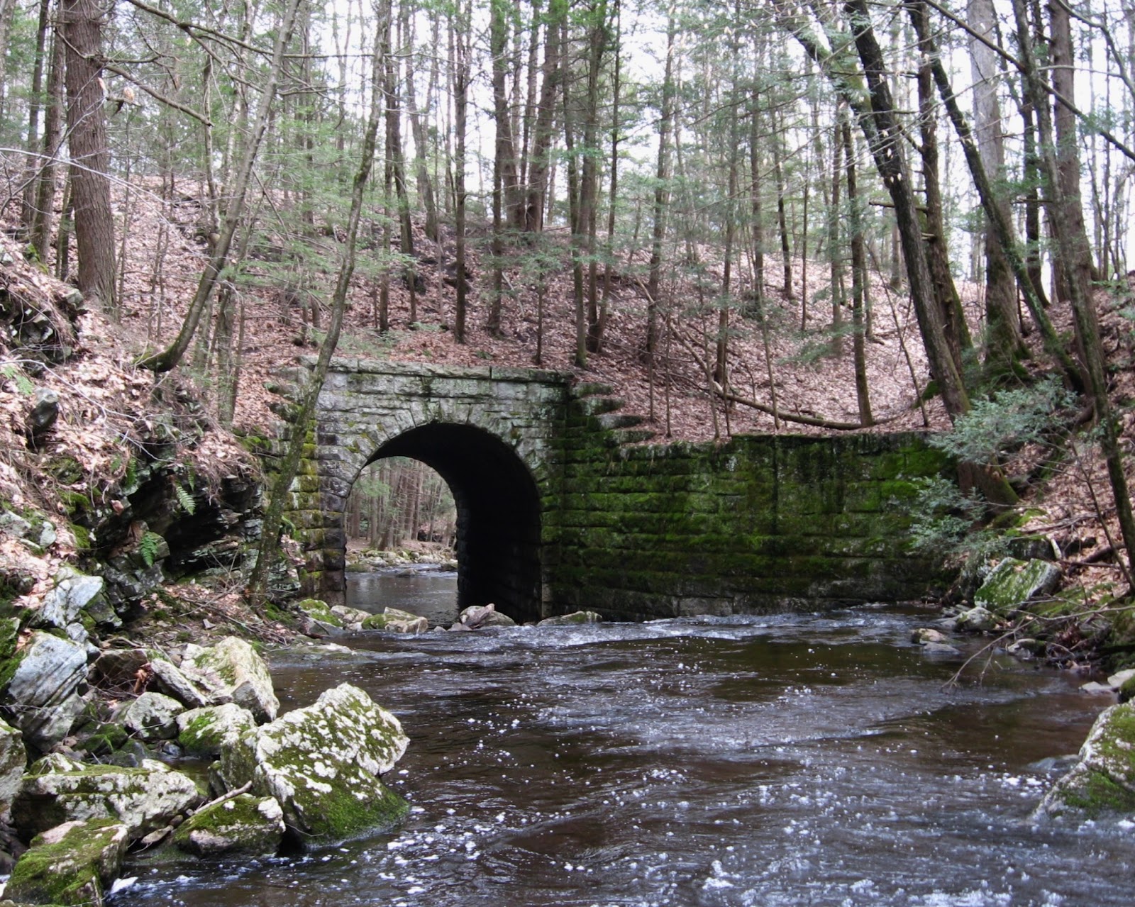
Parked at Sean Patrick's Plants on East Howey Road at the top of a blustery hillside farm. The trail started off on a discontinued portion of East Howey road which is an old wagon road lined with stone walls and descends to Knowlton Brook where stone bridge abutments still remain and the road continues on the other side of the brook as it winds it way up into the woods. We followed the yellow trail which brought us along the brook amidst the skunk cabbage and frogs and back to the lot.
A short hike and an amazing area to see for its old farms and fields.
Monday, April 14, 2014
Bare Mountain
Bare Mountain, South Hadley, MA
04/13/14 11:00 am-1:50pm 60's and hazy skies with partial clearing.
Parked off Amherst Road and walked through the Judd Reservation to Robert Frost trail to summit.
Brief shower on the way but nice spring Sunday morning. We had to resort to off trail wandering a little before we came to the yellow trail and eventually the Robert Frost trail (Red) which led us up the seven sisters ridgeline to the summit of Mt Hitchcock at 1005'. A tough climb for the first hike of the season! We went up and down the humps that straddle the ridge line before coming to Bare Mountain at 1010' with a 360 degree view of the pioneer valley. There were many hikers on the trail today. We decided to make a loop back to the car and descended the ridge to the Notch Visitor Center and a brief walk along Route 116 and past huge stone quarry to car.
We had lunch at Fitzwilly's in Northampton, MA and the town was bustling with people enjoying the bright warm sunshine.
Monday, April 7, 2014
Willington, CT 12:07-2:08 pm. Cloudy and chilly. Fenton-Ruby Park and Dobney Wildlife Sanctuary.
A new hike starting on Taylor Pond Loop To Julia Trail. Spring Peepers peeping in vernal pools and pond. We made our way down to the Fenton River which is running strong and fast through farm lands and forest. We followed several wagon roads and continued on Green Trail back to Pond. We came to a wide wagon road lined with high stone walls and cellar holes on top of a hill. Old and rusted primitive iron fixtures littered the forest floor in places indicated an old smelting or blacksmith shop was in operation here a long time ago. A gravel road led back to car and parking area with picnic table offering views of the Fenton River, wetland habitat and distant farm land. It seems like a great place to fish with an old dam upstream and deep pools to support trout.
Wednesday, April 2, 2014
Connecticut Path cont.
Eastford, Connecticut hike on The Connecticut Path (Walker Road)11am-3pm Cloudy and hazy but mild with breeze.
Parked off Walker Road and hiked down wooded track to site of old schoolhouse (circa 1860's). A lot of colonial development with interlacing stone walls and a few cellar holes and an old well. We came to a beaver pond and saw two herons. After we located the schoolhouse foundation we followed the sound of rushing water down a short hill. I was startled to catch two coyotes-yikes! crossing the trail and was able to capture them on camera as they stopped to check us out before they scampered off into the woods again.
We then came to the other side of the Bigelow Brook and the site of the old bridge and stepping stones. The water was high from spring thaw and good for fishing. Me and my father walked back to car along the same route. We stopped on Eastford Road to look over the Bigelow Brook bridge at the trout swimming in a deep pool.
Saturday, March 22, 2014
The Connecticut Path, Eastford, CT 12:30-3:00 pm
Partly Cloudy turning to sun and mild temps with a high of 56!
The Old Connecticut Path a colonial era path over Indian Trails from Cambridge, MA to Hartford, CT. Started out with sleet and overcast conditions with slushy snow on top of an iced over dirt road. Went past several cellar holes with interesting stone wells and running springs.
Came by an iced over pond and brook and then to a hillock with extensive stone walls inundating the landscape. We decided to march down another wagon road towards the sound of a river on the other side of a ravine. We got down to rivers edge and I was amazed to find such a hard flowing river and what looks to be prime fishing habitat!
We followed a wide wagon road along the river for quite some ways and having crossed a brook with old stone abutments on either sides of it. We decided to continue on in a direction back towards the area in which we parked taking a chance of looping our way back. At least 3 inches of snow still covered the ground in this deep hollow and freshets overflowing with runoff snowmelt made it wet and slippery in places.
We did find the remains of the old stone bridge over the Bigelow Brook and the Indian Stepping Stones. An amazing spot! We followed this path which continued onwards towards Massachusetts on the other side of the river.
Climbed a steep rise to a few modern homes tucked away in the deep woods and made it back to the car in a perfect loop.
Thursday, March 6, 2014
Wolfs Den, Pomfret, CT 10am-12 noon.
Very cold and in the teens. Mashamoquet Brook State Park and Wolfs Den Campground.
Drove along Route 44 and came across Brayton Grist Mill and Marcy Blacksmith Museum which is closed for season but an amazing site along snow covered and iced over brook. Old bridge and millrace and plenty of hiking trails to explore in better weather conditions.
I found location in 50 Hikes In Connecticut 5th edition book.
Monday, March 3, 2014
Skiing 10-11am.
Cloudy, cold and in the teens with a stiff occasional breeze and frozen and hard packed snow fast for skiing but difficult maneuvering ruts and snowmobile tracks.
The farm dogs across the fields are already barking just as I step out the door.
Fat Robins perched in shrubs along the pond. I fed the geese crackers. Two ducks flying over fields towards Lafayette Pond where I am heading to. Grey, blue and white landscape.
View of Bald and Perkins Mountains with some unidentified peaks to the north including a cone shaped hill in either Somers or Hamden MA. A new hunting blind built into small rise. I flushed barn swallows from shrubbery.
I followed dirt road down to pond which is well frozen over to allow even snowmobiles to cross. I stood over dam that was erected in the 1800's to harvest ice from Lafayette Pond. Woods Stream flows out of pond creating a small wetland between housing developments twisting through downed trees and swamp thickets.
I crossed the pond again and had to herringbone my way up a steep rise above the pond before getting into the field and past several huge brush piles stacked in the wood line.
Many deer tracks skirting open fields. Snots flowing and jacket stiff from cold as I grasp for handkerchief.
Thursday, February 27, 2014
2/27/14 10 a.m.-11:50 a.m.
Cross Country Skiing in backyard.
Breezy and cold about 20 degrees with partly sunny skies.
Me and my Father crossed Shaker/Somers Road and skied along Terry Brook Marsh which was running strong underneath the ice where reeds were bent and frozen. Bull rushes and cat tails stood over the snow along with the bare tree trunks. Marsh birds flitted about including one American Tree Sparrow picking through the reeds at the edge of the brook. A small hairy woodpecker knocked for wood boring insects. We followed deer and snowmobile tracks with fast conditions for skiing and hard packed snow. Old rusting lubrication drums colorful against the white snow. I had a little snow blindness while making my way along the wide open field expanse. I watched a single page of the daily newspaper tossed by the wind get blown into the deep pine wood.
One Pine meadow was littered with several large piles of old tractor and car tires, some whitewalls from the 50's. Me and my father made our way around the back of the Rushmore Farm property. Under the tree line of stately pines were various neatly arranged farm implements in disuse including old plows and trailers, metal refrigerators and generators, children's tricycles and Tonka toys and a red wagon, and bales of wire. A flock of crows fought in the distance.
Wrights Brook wound around farm property and we made notice of large animal tracks.
Crossed Somers/Shaker Road again and skied hard straight up corn field to small knoll overlooking Bald Mountain and Perkins Mountain off in the distance. I caught my breath under a rustling oak tree and took in the sunny expanse of the vast bean field in snow with cloudy blue big sky.
We skirted the adjacent tobacco field following along Terry Brook past a huge compost heap stinking in the midday sun and past maintenance sheds to Trout Pond.
I fed the two farm geese stoned wheat crackers before crossing frozen over pond into the field in our backyard and headed home.
Sunday, April 21, 2013
Opening Day of Fishing Season
MB -Hop River State Park Rails to Trails
4/20 Sat 1-4pm.
Cloudy, haze and some sun w breeze and in the 50's.
Windham and Columbia CT
Route 6 in Windham, CT and parked in lot across from U-Haul and Card Mill Road.
Biked West to Willimantic and freight yard along Riverside Drive but no trains.
Biking west into Columbia, CT on Hop River State Park Rail to Trails.
Remote section and trail less maintained. Crushed ballast and sand. Two CHD markers alongside Route 6 "Connecticut Highway Department" cement markers. Small bridge over farm track through pasture land.
Stopped at old railroad bridge over the Hop River which is out and impassable. Picturesque spot with flood damage to old stone abutments and rotting railroad ties. I turned back to parking lot to continue my journey from the other side of bridge.
Pucker Street tunnel on Roses Bridge Road. I parked at a fishing turnoff near one way bridge and biked down side embankment of tunnel to pick up trail to head both east and west.
Many fishermen along Hop River. Met up with passing girl on horseback with a skittish thoroughbred. Coventry Open Space marshlands on both sides of trail with waterfowl and ponds.
Some old stone stream crossing bridges and highway overpasses. Stopped at other side of old bridge with sun shining. Found a Hemingrey No. 40 dark green/blue glass telegraph pole insulator in leaf litter and put it in my pocket as a souvenir.
Picturesque farm with a few red pines and rocks on other side of fenced in meadow.
Old blue enamel ware pot left on tree stump. I walked alongside the riverbank at a quiet spot of hemlock and pines. The rail grading was shored up here with fieldstone.
I passed by parking area and lot where I parked by mistake having missed the tunnel exit location. I continued on after noticing new scenery. Amazing stretch of river between Pucker Street tunnel and Parker Bridge Road parking lot. Came across a fishermen's encampment.
The trail well maintained with red sand and gravel. Passed dog walkers and fishermen. One boy caught a large trout and was having his picture taken. Great fishing spots. I found a new river to fish!
I made my way to the Parker Bridge Road lot and turned back having finished the Bolton to Windham sections of trail.
KFC in East Windsor for dinner, as I skipped my lunch.
Thursday, April 18, 2013
04/17/13 Hop River State Park Trail, Columbia, CT
Mountain Biking Hop River State Park Trail
Burnap Brook Road, Andover, CT lot to Parker Bridge Road Lot, Columbia, CT.
Clear Blue Skies with some wind and 60's sunshine.
1 pm.-3:20 pm Crescent moonrise in east.
1:15 pm. leave Burnap Brook Road Lot and head east on rails to trails. Interesting stonewalls and former wagon roads intersecting trail. Andover History Museum parking. Old white colonial home with large Norway Spruce in front yard. Old iron farm implements on lawn.
Lake Road crossing with Cheney Brook stone bridge. Fresh spring green leaf shoots on shrubbery with view of sunlight reflected off brook dancing on inside of tunnel.
I found a new river after riding under Rt. 6 tunnel with small brook entering it and creating a falls. The Hop River!
2:45 arrived at Parker Bridge Road lot and turn around into the wind. An excellent railroad straightaway with extended view of path through grey leafless trees and old telegraph poles.
3:18 Returned to Burnap Brook Road lot and depart with windows off jeep, Yippee.
4 pm. Reins Deli in Vernon, CT for lunch of Reuben on rye and cream soda for late lunch.
Tuesday, April 16, 2013
04/15/13 Patriots Day at Wells State Park
Hiking at Wells State Park, Sturbridge, MA
Partly Cloudy, in the 60's
9:30 am leave home for Wells State Park in Sturbridge. MA. Never been there before but looks like a good hiking spot with some historic features and a lookout called Carpenter's Rocks.
Arrived at 10:15 and parked in lot at Perez Walker Homestead. A few cellar holes remain of 1790-1889 homestead.
We took the Red blazed North Trail. After a brief hike we came across a girl in trench coat, hoodie and wearing headphones trudging up the mountain.
Crossed under crackling power lines with two pine saplings adorned with Christmas bulbs.
Crossed paths with same girl hiker again. Ceramic MTB placards posted on trees as trail markers.
11:35 came to Carpenter's Rocks overlook with view of distant hills grey with evergreens spotting distant hills. Very steep 100 ft. drop off to the forest floor below. Pine and black birch on rocky outcropping.
Took yellow trail down to Mill Pond. Old 18th Century dam site and flooded marsh. Beaver dams and platform nests where four or more wildfowl birds, possibly great blue herons nesting above marsh. Followed stream to stone pool and raceway. At another pond we noticed a dump sight with glass glistening from under leaf fall and chose to investigate. Picked through some 50's bottles.
Dome Perez, Jersey bottle but decided not to carry it away.
Made it back to car at 2 pm. Upon leaving we pulled over to watch a blue heron take off in adjacent swamp.

Hiking at Wells State Park, Sturbridge, MA
Partly Cloudy, in the 60's
9:30 am leave home for Wells State Park in Sturbridge. MA. Never been there before but looks like a good hiking spot with some historic features and a lookout called Carpenter's Rocks.
Arrived at 10:15 and parked in lot at Perez Walker Homestead. A few cellar holes remain of 1790-1889 homestead.
We took the Red blazed North Trail. After a brief hike we came across a girl in trench coat, hoodie and wearing headphones trudging up the mountain.
Crossed under crackling power lines with two pine saplings adorned with Christmas bulbs.
Crossed paths with same girl hiker again. Ceramic MTB placards posted on trees as trail markers.
Took yellow trail down to Mill Pond. Old 18th Century dam site and flooded marsh. Beaver dams and platform nests where four or more wildfowl birds, possibly great blue herons nesting above marsh. Followed stream to stone pool and raceway. At another pond we noticed a dump sight with glass glistening from under leaf fall and chose to investigate. Picked through some 50's bottles.
Dome Perez, Jersey bottle but decided not to carry it away.
Made it back to car at 2 pm. Upon leaving we pulled over to watch a blue heron take off in adjacent swamp.
Sunday, April 14, 2013
Scully Road NLT fire road, Somers CT
Overcast and blustery.
Network of fire roads and trails and easy to get lost. Skirted ridge of Bald Mt and down around to old cellar holes. Made my way up and down muddy and rubble strewn tracks to housing development and turned back before I got really lost, I did not want to end up on the other side of Somers Mt. A nice stream flowed between two ridges and I stopped at a pool. I did not spend a lot of time reflecting or taking pictures and jamming down the mountain to release tension and be aggressive with the terrain made for a great work out. The sun began to shine as I made my way back to abandoned hunting cottage and down to Scully Road.
A lady at Geissler's Supermarket in Somers asked me in the parking lot after seeing my muddy bike asked where I went mountain biking. I told her and that the conditions were in fact muddy, but that's not necessarily a bad thing. She mentioned trying Robinson State Park in Agawam.
Saturday, April 13, 2013
04/11/13 Hop River State Park Trail
Thursday, 9:40 am to 2 pm.
Weather: Cloudy and chilly
Destination: Bolton, CT
Activity: Mountain Biking
Arrived at Bolton, CT park and ride lot and set out on Hop River Linear Rails to Trails for Andover, CT.
Massive concrete tunnel for Route 44 overpass and its junction with Route 6. Runoff streams on both sides of trail and cut rock cliffs.
Old remains of quarry operations.
Hewn cliffs with tell tale rock splitting marks and stone overpass.
Some telegraph poles still standing.
Stunning stone bridge for stream with water tumbling down into small pool.
Steeles Crossing Road with several old roads crisscrossing over trail.
Bailey Road Crossing
Rose Trail and Bolton Heritage Farm junction.
Burnap Brook Road crossing and parking lot in Andover, CT. Walked down to waters edge and was afforded great view of waterfall and railroad bridge.
At noontime I turned back.
Back to parking lot at 2 pm and departed.
Thursday, 9:40 am to 2 pm.
Weather: Cloudy and chilly
Destination: Bolton, CT
Activity: Mountain Biking
Arrived at Bolton, CT park and ride lot and set out on Hop River Linear Rails to Trails for Andover, CT.
Massive concrete tunnel for Route 44 overpass and its junction with Route 6. Runoff streams on both sides of trail and cut rock cliffs.
Old remains of quarry operations.
Hewn cliffs with tell tale rock splitting marks and stone overpass.
Some telegraph poles still standing.
Steeles Crossing Road with several old roads crisscrossing over trail.
Bailey Road Crossing
Rose Trail and Bolton Heritage Farm junction.
Burnap Brook Road crossing and parking lot in Andover, CT. Walked down to waters edge and was afforded great view of waterfall and railroad bridge.
At noontime I turned back.
Back to parking lot at 2 pm and departed.
Subscribe to:
Posts (Atom)